On Point: The Cansel Blog

Posts by

Cansel Team

The New Geodetic Reality of Mobile Mapping Technology

via Trimble Geospatial

Q and A with Chris Power of Leigh Surveyors: The New Geodetic Reality of Mobile Mapping Technology

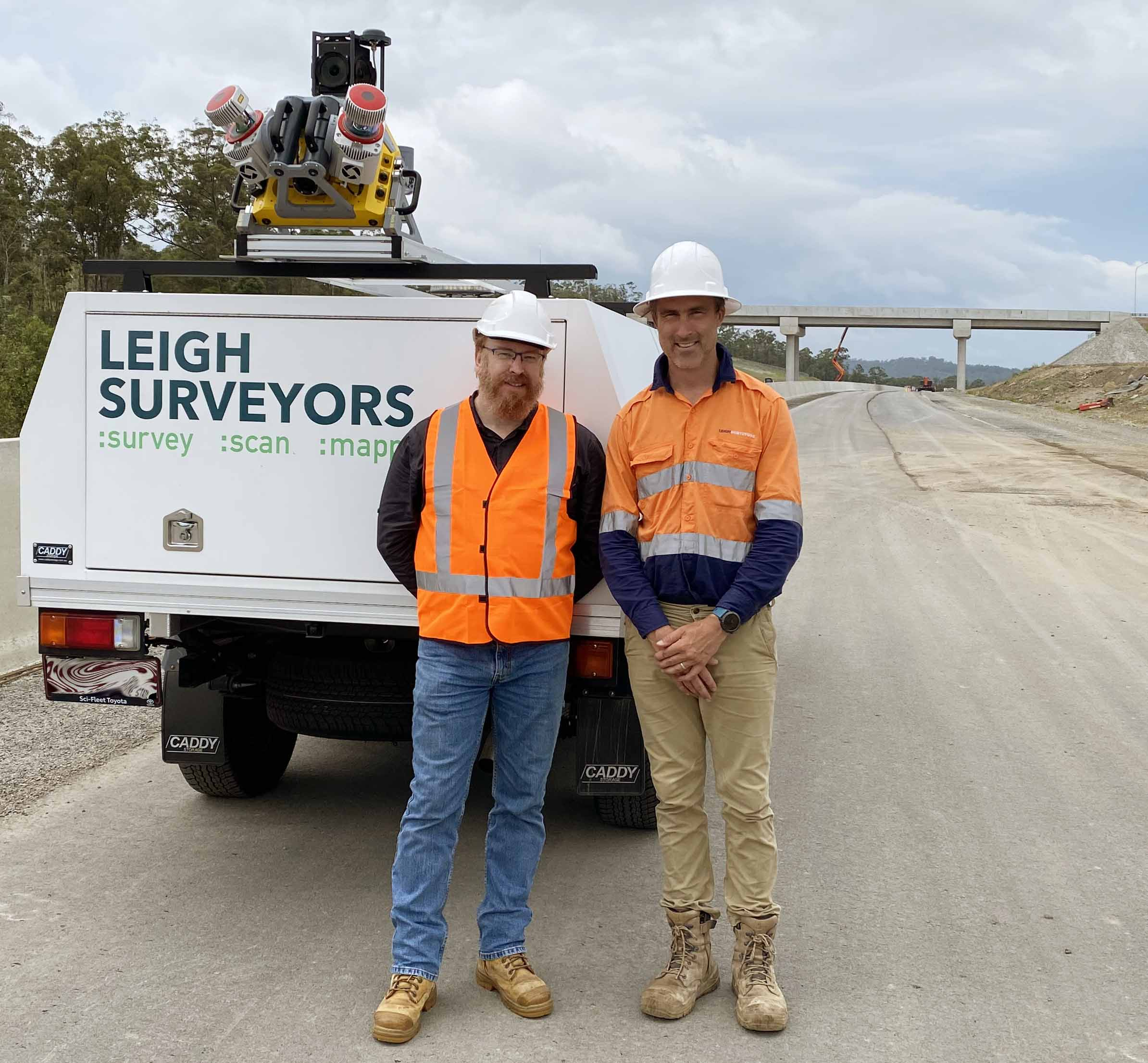
Based in Brisbane, Queensland, Australia, Leigh Surveyors is a specialist in the transportation infrastructure market. The company maintains its leadership with continuous investment in technology, such as LiDAR and scanning/total stations, and more recently mobile scanning to deliver more comprehensive and accurate solutions, and set a foundation for digital twins. The firm was recently honored with the Best Civil Engineering Surveying Company award by Australian Enterprise Awards 2023.

Read More

Digital Technologies: Road Upgrades with Trimble MX9 and Trimble S7

via Trimble Geospatial

Widening One of the Busiest Stretches of Road in Italy

The upgrade of a dynamic fourth lane on the A4 highway in Italy relied on road construction company Del Bono SpA and Trimble technologies’ improved process management to enable crews to safely and quickly work on a complex, dangerous construction site.

The project involved the construction of a dynamic lane through the temporary use (for one direction of the road or both) of a fourth lane carved out of the emergency lane and redistribution to the traffic lanes of the A4. In the event of heavy traffic situations, thanks to the installation of signaling systems that dynamically indicate lane opening and speed to drivers, traffic backups on one of the busiest roads in Italy will be mitigated.

Read More

Rail Monitoring: Easier Than Ever

via Trimble Geospatial

Rail Monitoring Overview

Rail monitoring is a critical component to ensuring safe and continuous rail traffic, and it has typically required a substantial amount of manual data collection and calculations. Often rail monitoring is an activity that plays a critical role in the support of rail line operator safety during construction projects on or close to existing railroad tracks. Frequent rail monitoring can also help identify track changes caused by activities such as tectonic movement, heat waves, and other environmental conditions. Conventional methods used for rail monitoring are time-consuming—requiring multiple surveyors to manually collect each point along the rails—and often cause disruption to traffic flow and pose a potential risk to workers. In addition, complex calculations for large amounts of data are typically managed manually, impacting efficiency.

Read More

TerraFlow Mapper Products Update Available

The next versions of TerraFlow Geomatics' Utility Mapper (version 1.0.0.45), Pole Mapper (version 1.0.0.35), Sensor Mapper (version 2.0.0.45), and Surface Mapper (version 1.0.0.16) are now available on the Google Play Store. 

There is a variety of updates to the systems which will be detailed in the following sections. Also included below is an update on the continued development of the sketch tools inside of DataEngine.

Read More
The Future of Work Trimble Dimensions+

Trimble Dimensions+ 2022 Keynotes

The keynote speeches at Trimble Dimensions+ 2022 set the tone for three days packed with inspiration and education. We're thrilled that the team at Trimble has made them public so we can share them with our friends and colleagues who weren't there to enjoy them in person.

Read More