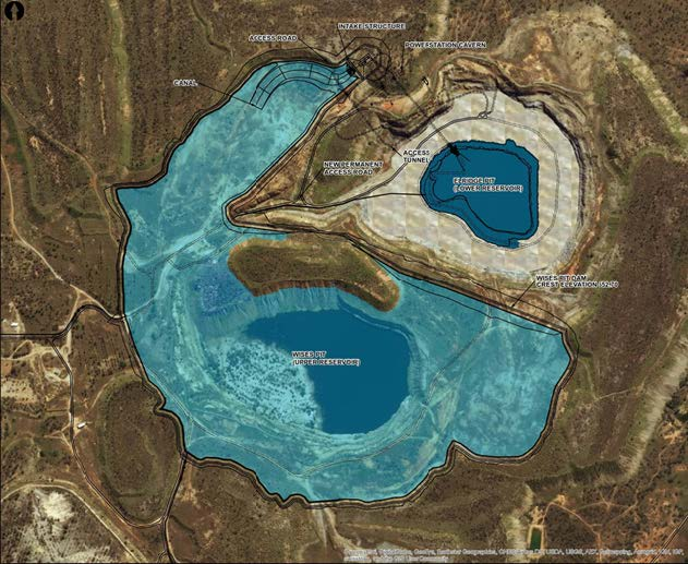
Kidston Pumped Hydro Project
An innovative project success story from Trimble Authorized Distributor UPG that involves the world-first conversion of a disused gold mine into a pumped storage hydroelectric power generation facility in Australia.
Posts by
An innovative project success story from Trimble Authorized Distributor UPG that involves the world-first conversion of a disused gold mine into a pumped storage hydroelectric power generation facility in Australia.
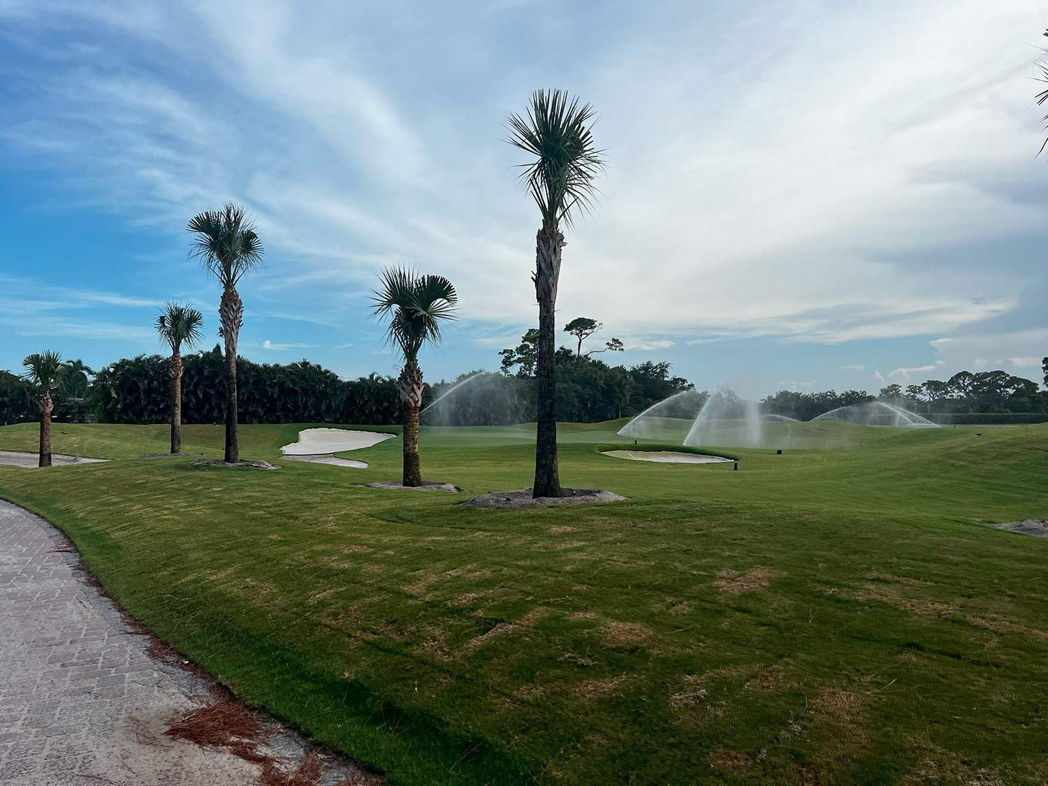
Likely the first thing you think about when you hear the storied names of Colonial Country Club, Oakmont Country Club, Muirfield Village Golf Club and Bel-Air Country Club is perfectly manicured fairways, challenging rough and smooth greens—not irrigation systems. But, of course, effective watering practices are a key to making these golf courses look so spectacular.
For Michigan-based Michael Kuhn and Associates, Inc., golf course irrigation is a life’s work. Led by founder Michael Kuhn, this industry leading firm’s expertise in agronomy, engineering and technology is changing the way irrigation systems are designed, managed and updated.
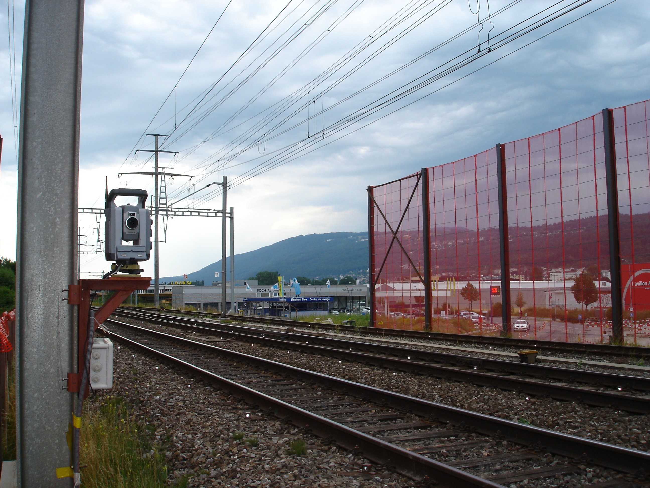
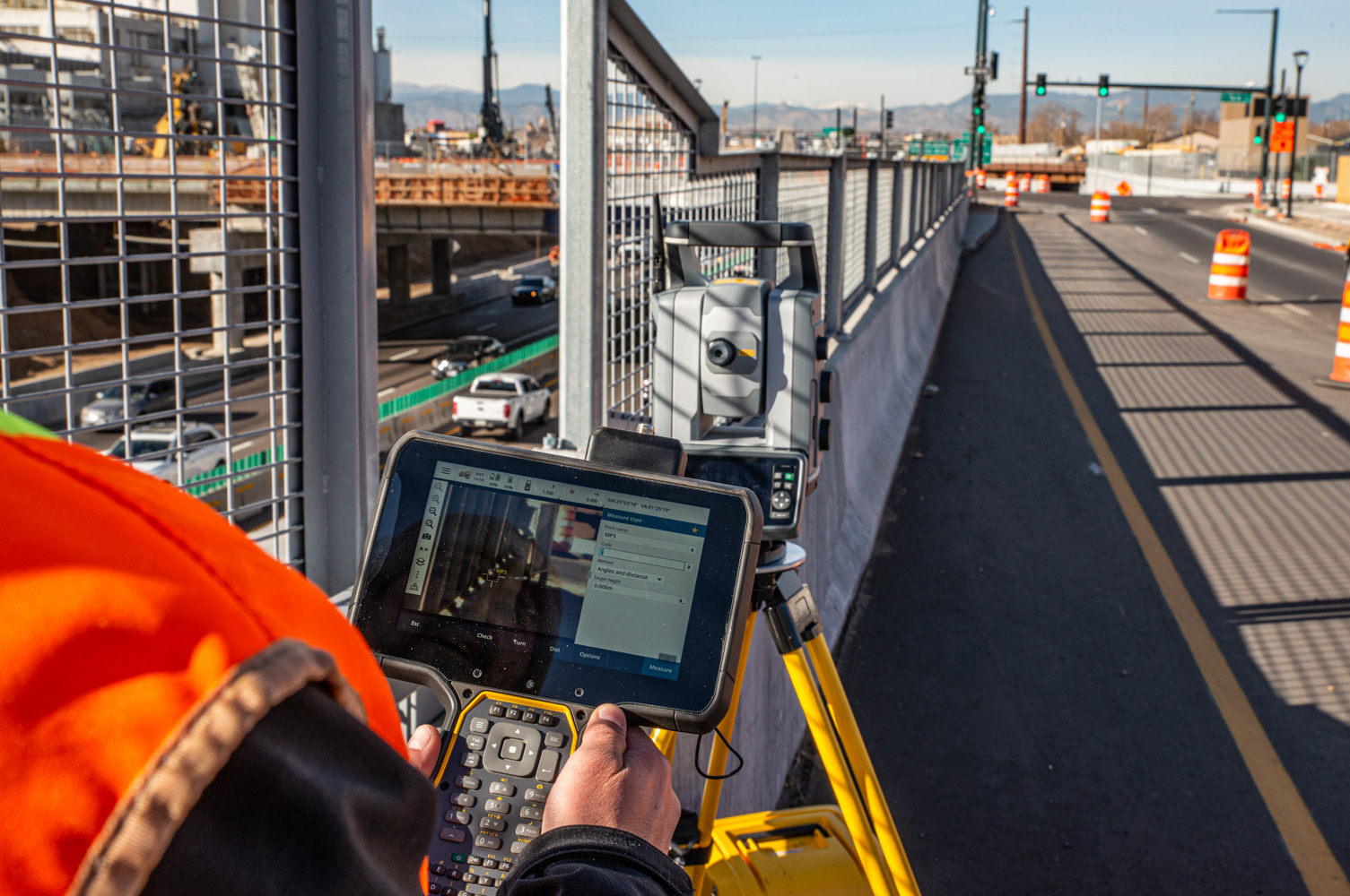
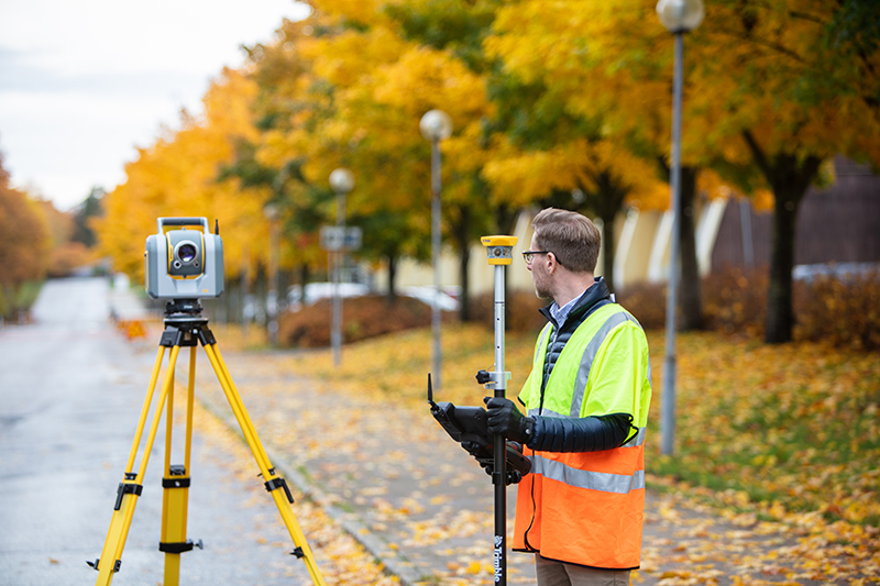
Deformation monitoring, the task of measuring an object's movement over time, plays a crucial role in assisting the construction process and understanding a structural asset's health. Owners, operators, and contractors rely on automated monitoring systems to measure and report on the movement of these objects to ensure public safety, protect the asset, and make informed decisions. Survey providers can easily take existing survey principles and equipment and apply them on an automated monitoring project. Total stations provide accurate, repeatable measurements to understand this key movement and accompany software platforms visualize and report the data in meaningful ways.
This article explains the differences between automated and semi-automated (or manual) monitoring, where and when an automated system is beneficial, and the steps to turn an existing robotic total station into an automated monitoring system using Trimble 4D Control (T4D).
Rapid advances in artificial intelligence (AI) capabilities provide numerous advantages for surveyors as they integrate and streamline data management in a data-abundant ecosystem. By training machines to do time-consuming, repetitive activities, such as point cloud classification and feature extraction, humans have more time available to complete the most valuable components of the workflow.
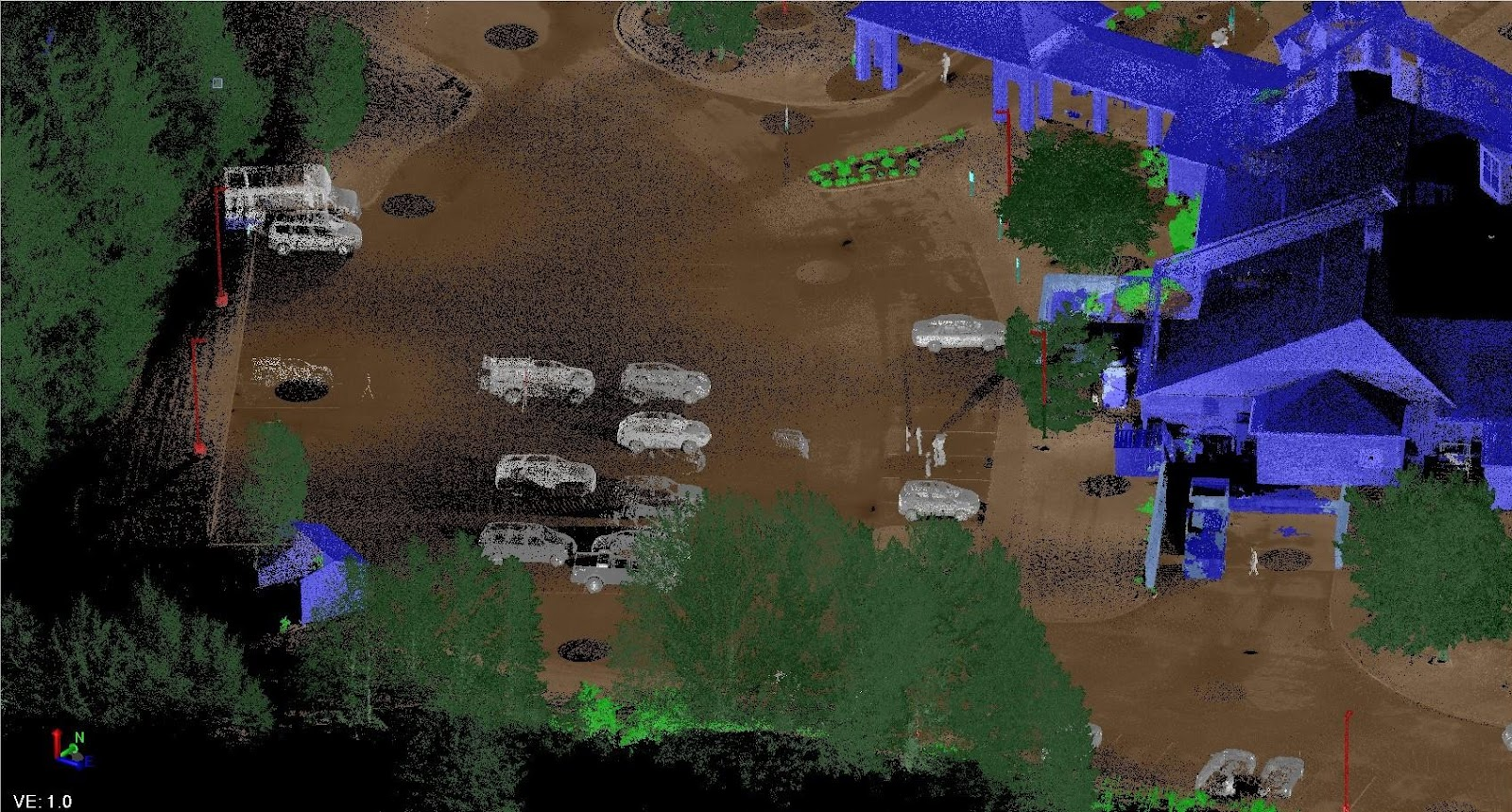
“Point cloud classification will be very useful for feature extraction. Great job so far. We really like it.”
- Alex Garcia, National Manager, Mobile Solution, GeoVerra
Rapid advances in artificial intelligence (AI) capabilities provide numerous advantages for surveyors as they integrate and streamline data management in a data-abundant ecosystem. By training machines to do time-consuming, repetitive activities, such as point cloud classification and feature extraction, humans have more time available to complete the most valuable components of the workflow.
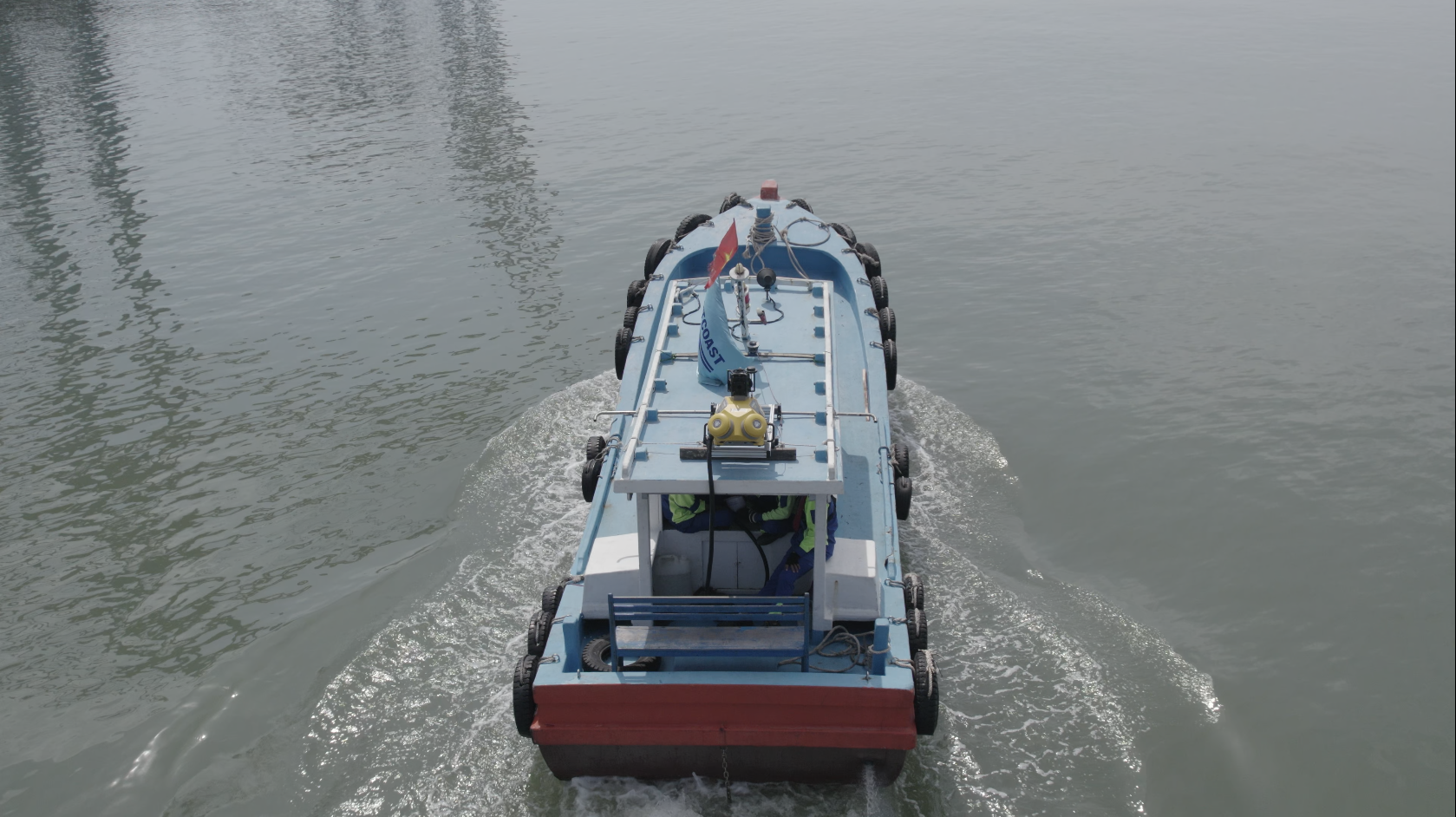
Some areas of the massive Gemalink Port in southern Vietnam are inaccessible by land, making it difficult to capture the data needed to build a comprehensive digital twin of the facility. Using an innovative approach, Portcoast Consultant Corporation mounted a Trimble MX50 mobile mapping system on a boat to successfully scan the container terminal and nearby riverbank. The results were combined with terrestrial data to obtain a complete data set.
Manufacturers produce either silver- or copper-coated prisms to reflect laser wavelengths, but what's the difference?
In the early days of electronic distance measurement (EDM), in the mid to late-20th century, there was a school of thought that copper-coated prisms better reflected the laser wavelength of the instrument and not as much of the visual wavelengths. This may have been true back then when EDM instruments had very weak light sources when compared to today's standards. Today's EDMs have much stronger lasers and narrower bandpass filters on the receiver, making any difference negligible.
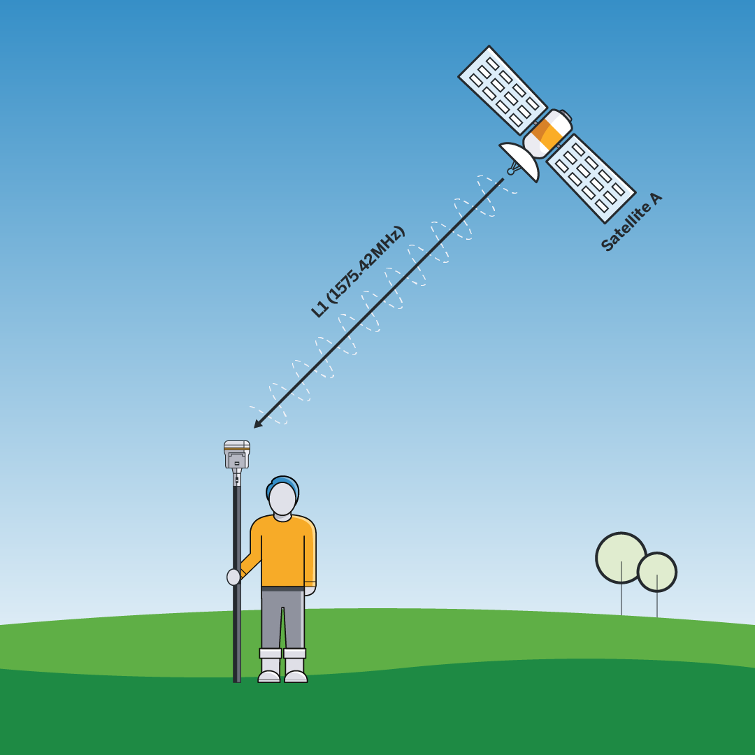
The number of channels in GNSS receivers seems to be going up and up: 672, 555, 1408... but what does it all mean when there are only about 120 operational navigation satellites in orbit? Is it a case of “the more, the better”?
Let’s take a look at what’s really happening between space and Earth, and explore why there are so many receiver channels with relatively few satellites in orbit.

For Strathcona County, a specialized municipality in the Edmonton Metropolitan Region in Canada, a smart future requires a smart roadmap—literally.
But this is no ordinary roadway map; it’s essentially a digital twin, one that includes comprehensive details about the extent, condition, performance, use and operating characteristics of every public road in the municipality.
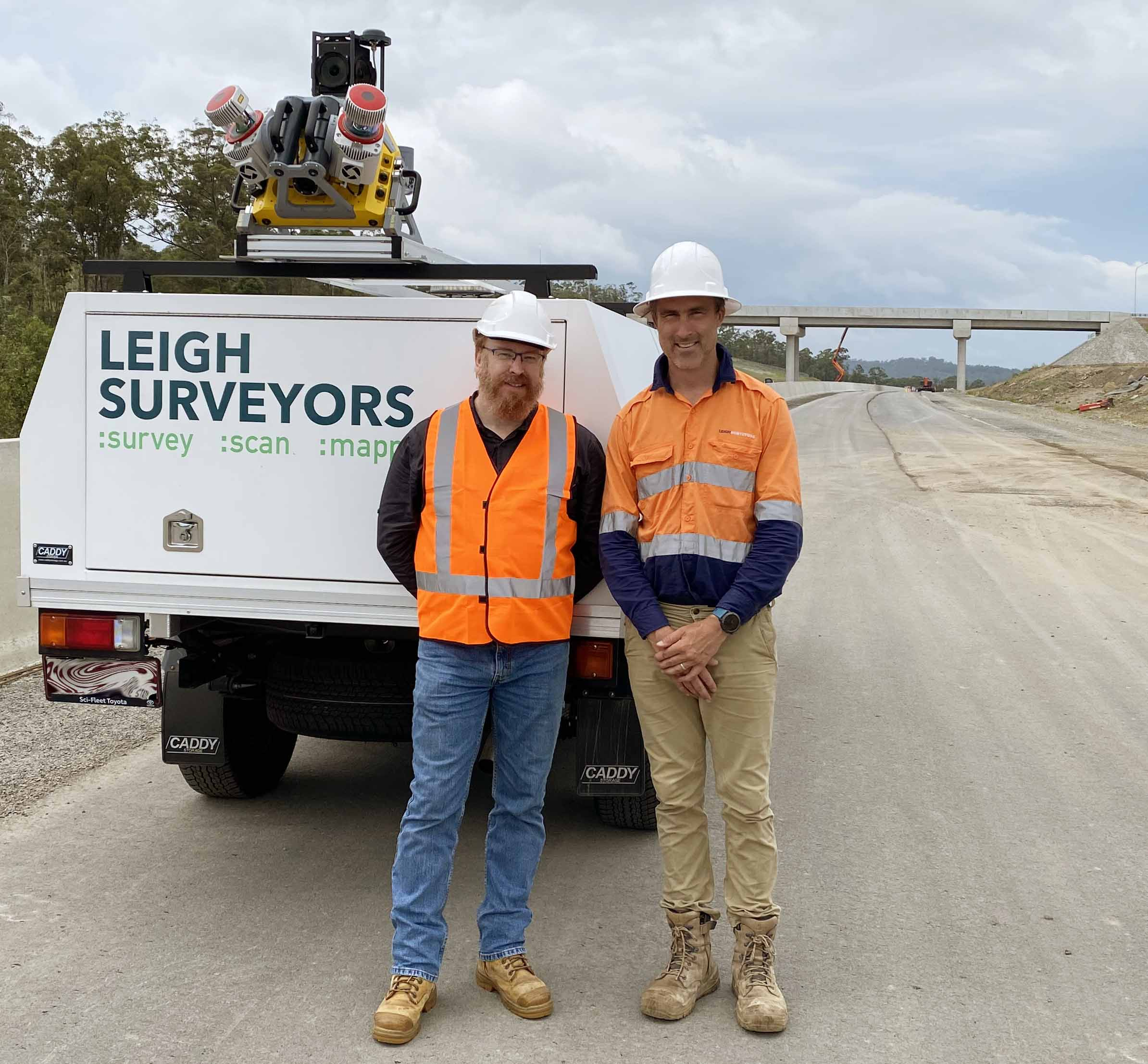
Based in Brisbane, Queensland, Australia, Leigh Surveyors is a specialist in the transportation infrastructure market. The company maintains its leadership with continuous investment in technology, such as LiDAR and scanning/total stations, and more recently mobile scanning to deliver more comprehensive and accurate solutions, and set a foundation for digital twins. The firm was recently honored with the Best Civil Engineering Surveying Company award by Australian Enterprise Awards 2023.